Google and Real Turkey

Özel Arama
I am a citizen of Istanbul and you can find my recommendations regarding what you should do during your stay at Istanbul.

You know, most of the tourists just visit the most popular places and return to their countries without experiencing the real city life.

The objective of my blog is to help you to see the real city life in Istanbul.

Monday, May 21, 2007

Saint Antoine's Church in Istanbul

Saint Antoine's Church is one of the most beautiful churches in Istanbul.

"Saint Antoine's Church"
Photo owner: Kıvanç


Located in İstiklal Street in Beyoglu, the Saint Antoine Church is on the left side of the street if you are facing from Galatasaray towards Tunel.

Construction began in 1906 and the church was completed in 1912. Its architect, Giulo Mongeri, who was born in İstanbul, gave it an Italian Neo-Gothic style. Today it is İstanbul's largest church with the busiest congregation and is run by Italian priests. The Church was built in a courtyard. The entrance of the church in on the main street between two apartments which were built to earn money for the church.

Conquest of Istanbul ( Constantinople ) or Fall of Istanbul?

GREEKS still consider Tuesday an unlucky day. May 29th 1453, was a Tuesday; the day that Constantinople, the place they called—and often still call—the queen of cities, or simply “the city” was overrun by the Ottoman forces that had bombarded its mighty walls for the past 40 days.


Friday, May 18, 2007

Princes Islands


The group of nine islands in the Sea of Marmara is known as the Princes' Islands and is only an hour away from the city. There are regular boat services to four of the islands from the entrance of the Golden Horn and Kabatas. Pier.

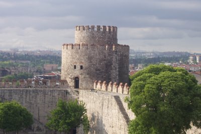
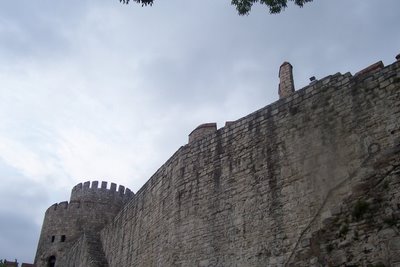
In Byzantine times a number of monasteries were built here, and the islands served both as summer resorts and a place for exiles. Copper was mined in Heybeli Ada. On this island, in the courtyard of the Naval Academy there is a small church dedicated to the Virgin. This is the last Byzantine structure in the city.

The steamboats that started serving the islands in the early 19th century facilitated access to the islands, and the population started to increase rapidly when schools and hotels were built.

The four larger islands grouped close to each other are covered with summer residences, villas and pine groves, and are famous for their beaches and picnic areas. The islands are crowded between May and late September, but deserted in other times. The residential areas have developed mostly around the piers and those sides of the islands facing the city. The only means of transport on the islands are horse-drawn phaetons. During the summer season, and particularly on holidays, the bays and beaches attract private yachts and motorboats.

There are no settlements on the conical shaped Hayirsiz Ada, the first island seen from the ferryboat, nor on the next one, the flat Yassi Ada. The boat first stops at Kmah Ada, famous for its open beaches and the little cove at the rear. On this island the horse carriages are for transporting goods only, and not for passenger transport. There is a small, modern mosque on the shore and some beautiful old mansions.


Burgaz, with its rocky beaches, comes after Kmah. The premiere sailing and water sports club on the islands is here. The house of Salt Faik Abasiyanik, the famous writer, who lived on the island has been converted into a museum, and in Kalpazan Kaya, a place he used to visit often, there is now a cafe where one can watch a marvelous sunset.

Between Burgaz and Heybeli there is the private Kasik (Spoon) island, so-called because of its shape.

Approaching Heybeli Ada, there are two large buildings that catch the eye. One is the Naval Academy, situated between the twin hills of the island, and the second is the Greek Orthodox High School, set on top of the other hill in the middle of pine groves, which is closed today. Another building of the Naval Academy is located near the pier. On the other side of the pier the shore is lined with restaurants and cafes. On the rear of the island there is a beautiful cove, and on the side overlooking Ka§ik island a public beach, the facilities of the marine sports club, and the famous Degirmen picnic area.

There are special paths for hiking over the hills and through the pine groves, offering beautiful vistas. Heybeli is relatively lively even in the winter months because of the schools and the sanatorium facilities here. The Halki Palas Hotel, dating back to mid-19th century, is open the year round. It was renovated and modernized in 1995.

The largest and the most famous of the islands is Buyukada. It takes two hours to go around the island in a phaeton, but the half-tour of the island, which takes only one hour, is more interesting.

The Yoriik All public beach is in a wonderful cove on the side overlooking the Heybeli. Next to it is the Dil promontory, a favorite spot for picnickers. In contrast to the heavily populated residential areas near the pier, the southern part of the island is quite desolate. Boats often visit the coves on this side.

On the higher slopes of the island, there is an old dilapidated hotel from the 19th century, perhaps the largest wooden structure in the world, which is trying to remain standing until the day when it will be restored. The area around the pier is colorful and bustling with the restaurants, cafes and shops situated here. There are four hotels that cater for guests in the summer months.

The next island is Sedef, which is inhabited, and the beach there is open to those coming from the outside.

The beautiful houses, well-kept gardens and the extraordinary views of the islands make an unforgettable impression on visitors.

Who was Mustafa Kemal Ataturk?

The real thoughts of Atatürk...

Cakkidi - Kenan Dogulu

Turkish artist Kenan Dogulu's best song Cakkidi...

Thursday, May 17, 2007

SULTAN AHMET MOSQUE (THE BLUE MOSQUE)


One of the most famous monuments of Turkish and Islamic art, the mosque is visited by all who come to Istanbul and gains their admiration.

This imperial mosque is an example of classical Turkish architecture, and it is the only mosque that was originally built with six minarets.

It is surrounded by other important edifices of Istanbul, built at earlier ages. Istanbul is viewed best from the sea and the mosque is part of this magnificent scenery.

Although it is popularly known as the Blue Mosque, its real name is Sultan Ahmet Mosque. Befitting his original profession, its architect Mehmet Aga decorated the interior fastidiously like a jeweler. Built between 1609-1616, the mosque used to be part of a large complex, including a covered bazaar, Turkish baths, public kitchens, a hospital, schools, a caravanserai, and the mausoleum of Sultan Ahmet. Some of these social and cultural buildings have not survived to our day.

The architect was a student of Sinan, the greatest architect of classical Turkish architecture. He applied a plan used previously by his master, but on a larger scale.

The main entrance to Sultan Ahmet Mosque is on the Hippodrome side. There is an outer courtyard, and the inner courtyard and the edifice itself are elevated.

From the gate opening to the inner courtyard one can view the domes, rising above one another in perfect harmony, over the symbolic ablution fountain in the middle and the surrounding porticoes.

There are three entrances to the mosque interior. The wealthy and colorful vista inside created by the paintings, tiles and stained glass complements the exterior view. The interior has a centralized plan; the main and side domes rise on four large columns that support broad and pointed arches. The walls of the galleries surrounding the three sides of the interior chamber are decorated by over 20,000 exquisite Iznik tiles. The areas above the tiles and the inside of the domes are decorated with paintwork.

The blue of the paintwork, which gives the mosque its name, was not the color of the decorations originally; they were painted blue during later restorations. During the last renovation, completed in 1990, the darker blue color of the interior decorations painted as its original light colors.

The floor is covered by carpets, as in all mosques. Next to the mihrab (niche aligned towards Mecca) opposite the main entrance, there is a marble minber (pulpit) with exquisite marble work. On the other side is the sultan's loge (box) in the form of a balcony. The 260 windows flood with light the interior space, which is covered by a dome 23.5 m in diameter and 43 m high.

The small market building, repaired and reconstructed in recent years, is situated to the east of the mosque, and the single-domed mausoleum of Sultan Ahmet and the medrese (religious school) building are to the north, on the Hagia Sophia side.

In summer months light and sound shows are organized in the park here. Sultan Ahmet Mosque occupies a focal point in city tours, together with the numerous monumental buildings and museums in the vicinity.

The minarets of the mosque are classical examples of Turkish architecture. The balconies are reached by spiral stairs. It is from these balconies that five times a day the believers are called to prayer - in our day using loudspeakers.

The domes and the minarets are covered by lead, and at the top of the minarets there are standards made of gold-plated copper. Master craftsmen repair these coverings very skillfully when needed.

Islam requires all Muslims to pray five times a day. When the believers hear the call to prayer from the minarets, they perform their ablutions (washing) and then pray. The noon prayer on Fridays and the prayers on other important holidays are performed in the mosques collectively, but other prayers can be performed anywhere.

In the communal prayers performed in the mosque, the imam takes the lead and he chants verses from the Koran. The areas of prayer for men and women are separate. In the central area only men are allowed to pray, while women take their places either behind them or in the galleries.

It is a characteristic of classical Turkish mosques that even in the most crowded day, the majority of the congregation can easily see the mihrab.

Galata Tower


Galata Tower

The galata tower was built in 1384. It was the highpoint in the city walls of the Genoese colony called Galata.


During the first centuries of Ottoman era the Galata tower was occupied by a detachment of Janissaries, the elite corps of the Turkish Army. In the sixteenth century the tower was used to house prisoners of war, who were usualy consigned as galley slaves in the ottoman arsenal at Kasimpasa on the golden horn.

During the reign of Selim 2nd (1566-1574) the Galata Tower was used as an observation point by the renowed Turkish astronomer Takiuddin, who had his main observatory in Pera. In the following century, during the reign of Mustafa 2nd (1695 - 1703) the seyhulislam Feyzulah efendi tried to set up an astronomical observatory in the tower with with the aid of a Jesuit priest, but the effort was cut short when he was killed in 1703.

The Galata Tower was reconstructed on a number of occasions in the Ottoman period, most notably, after a great fire that destroyed much of Galata in 1794 (during the reign of Selim III) and by Mahmut II in 1832. the tower's conical cap was blown off during a storm in 1875, and it was not replaced in the subsequent restoration. The tower was used as a fire - control station until 1964, when it was closed for restoratiom before being opened in 1967 as a tourist attraction. The conical cap was replaced in this restoration, giving the tower much the same appearance as it had in Genoese times, though retaining the changes in fenestration and other structual aspects done in the Ottoman period.


Wednesday, May 16, 2007

Greenpeace builds Noah's Ark on Mount Agri (Ararat)

Ship on the biblical mountain to warn of impending climate disaster.


Work has already begun on constructing a new Noah's Ark on Mount Ararat at an elevation of 2,500 meters. Measuring 10 by four by four meters, the ship being built by Greenpeace, will remind leaders of all nations that there's not much time left to mitigate a climate disaster with devastating consequences for all.

Photos of Turkey

I have taken some photos in my daily life...

Hagia Sophia and Istanbul's historical vessels


Hıdırellez Feast in Istanbul


Selimiye Mosque in Edirne


Galata Tower in Istanbul


A Classroom in Marmara University in Istanbul


The view of Carrefour from Marriott Hotel in Istanbul

Thursday, May 10, 2007

Neighbours of Turkey


Neighbours of Turkey
Greece
Bulgaria
Georgia
Armenia
Azerbaijan
Iran
Iraq
Syria

Tuesday, May 08, 2007

36 Hours in Istanbul

New York Times visited Istanbul for just 36 hours and describe Istanbul like that: "With architecture from the Roman, Byzantine and Ottoman periods as a backdrop, Istanbul is now the rare place where readers of Archeology and Wallpaper magazines can clink glasses with equal zeal."

Crossing the Bosphorus at dusk, you'll have knockout views of the illuminated minarets of the medieval Suleymaniye Mosque, right.

At the restaurant Mikla, the panoramic views make you feel as though you're soaring above clouds.

The six-century-old Grand Bazaar.


"Old Istanbul Map"


Piri Reis, Turkish Cartographer

Who is Piri Reis?
Famous Turkish sailor and the first Turkish marine cartographer. Piri Reis was both a great sea commander who was heroic and smart in battle and one of the most important cartographers and sailor writers of his time. Starting with his days of piracy, he systematically wrote down his observations. Works he produced written by using the material he found on marine cartography and marine geography and the maps he produced have a distinguished place in history of science. The world map he charted was printed by the Turkish Historical Institution in 1935. This map was presented by Piri Reis to Yavuz Sultan Selim in Egypt in 1517.


"Map of Piri Reis"


Drawn on leather by famous Ottoman sailor, geographer and mapdrawer Piri Reis (1457-1555) in 1513 with realistic additional information on the Atlantic Ocean, Africa and America. Kitab-ı Bahriye (Book of the Seas) (1521) by Piri Reis includes many maps very similar to modern maps. (Topkapı Palace Museum)

Monday, May 07, 2007

Which university in Turkey for Erasmus?

"ITU Faculty of Architecture"


Erasmus is a European Commission exchange programme that enables students in 31 European countries to study for part of their degree in another country.


If you think of studying in Turkey by Erasmus, I can advise you these universities:


Best Universities of Turkey


- ITU(Istanbul Technical University) www.itu.edu.tr


- ODTU(Middle East Technical University) www.metu.edu.tr


- Boğaziçi Üniversitesi(Bosphoros University) www.boun.edu.tr


- Hacettepe Üniversitesi www.hacettepe.edu.tr


- Ege Üniversitesi www.ege.edu.tr


- Dokuz Eylül Üniversitesi www.deu.edu.tr


Marmara University(www.marmara.edu.tr) is also known as a reputable university but it is very old fashion and it is a very seperated university with lots of campuses in every part of Istanbul. Also the technologic and physical conditions in Marmara are poor.

Friday, May 04, 2007

Turkish Cuisine and Saray Muhallebicisi

If you travel to Istanbul, you should eat traditional Turkish foods at Saray Muhallebicisi. Saray Muhallebici is so popular for its sweets.


Sakızlı Muhallebi

Kazandibi


Aşure

Thursday, May 03, 2007

Istanbul, The city where everyone must visit

Istanbul is certainly one of the best and most historical cities in the world. Have not you visited Istanbul yet?

EUROVISION 2007 TURKEY KENAN DOGULU

Kenan Dogulu and his song "Shake it up şekerim" will compete for Eurovision 2007 contest. Listen to this song and vote for Turkey in Eurovision.

Tuesday, May 01, 2007

Ephesus Ancient City, House of Virgin Mary, Artemis Temple


In the year of 10 BC, Androclos, the son of King of Athens-Kodros, was searching a location for establishing a site. Androclos belonged to Akhas, was running from the Dor invasion in Greece. He was leading one of the migration convoys. It was predicted by an Apollon oracle that a fish and a boar would show the location of the new settlement. Days later, parallel to the oracle’s prediction, while frying, a fish fell down from the pan, irritating a hiding boar behind the bushes. The feared boar escaped immediately. Androclos followed the boar and established the city of Ephesus, where he had killed the boar. When Androclos died in the wars with Carians, a mausoleum was built to the memory of the first king of Ephesus. The mausoleum is considered to be placed around "The Door of Magnesia".

Ephesus was ruled by the Lydian king, Kreisos, in the mid 6BC. The city reached the "Golden Age" and became a good model to the Antic World in culture and art, as well. But the inhabitants of Ephesus moved away. Because they did not like being ruled and lived in the new Ephesus that is located around the area of Artemis. As the detailed excavations have not completed yet, apart from the Artemis, the remains of that age haven’t been revealed.

Later, Ephesus was dominated by Persians. As Ephesians did not join the "Ionian Rebellion" against Persians, the city was saved from destruction. The rebellion resulted in the loss of Persian. Alexander the Great won Persians and the Ionian cities got their independence in the year of 334. Ephesus was in great prosperity during the times of Alexander the Great Until the arrival of Alexander the Great, Ephesus was consisted of two governing systems, democratic and oligarchic. But the oligarchic system was violated with the coming of a new ruler, and a rebellion existed in Ephesus. The Temple of Artemis was fired and destroyed by the supporters of oligarchy in 356BC. As the temple became unusable, Alexander the Great proposed for repairing. But the Ephesians delicately refused for the reason that "A God can not built a temple for a God." An Ephesian architect, Dinocrates restored the Temple of Artemis.

After the death of Alexander the Great, Ephesus was ruled by the general of him, Lysimakhos, in 287 BC. Lysimakhos decided to change the prior location of Ephesus to further west, due to the destruction of the port by the alluviums, and the inhabitants were forced to settle in the new place named "Arsinoeina", the name of Lysimakhos’ wife. The city was surrounded by wide stone walls in 10 meters height and 9 meters length. With the death of Lysimakhos, Ephesians destroyed most of the city walls. And, "Arsinoeina" was changed into "Ephesus" again, to be forgotten eternally.

Ephesus was controlled by the Romans in 190 BC. The city was given to the Bergamian kings for a time. With the death of King Attalos 3 in 133BC, the city was re-ruled by the Romans. Ephesus reached to its height and was notorious for its wealth and luxury between 1-4 AD., especially during the reign of Augustus. During the period, the population of Ephesus increased to 225 000, and the city became the capital of the new Asia. By cleaning the river Caystros from the alluviums, the great trade port of Ephesus, a gateway to foreign countries, enriched the prosperity of the city and continued to thrive with commerce and culture. The city was constructed, adding new models to the former magnificence of Ephesus. "Celsus Library" clearly exemplifies the perfecta of the era, with the delicate details of the construction.

Ephesus has played significant roles during the date, in the early Christianity, as well. The prestige of Ephesus increased with the arrival of Saint Paul, for spreading the Christianity to the Ephesians worshipping to Artemis. St. Paul and the disciplines of Christianity were strictly refused by Ephesians, elderly. With the long tiring struggles of St. Paul, Christianity was accepted by the most of the population around Ephesus. St. Paul had also sent one of his most famous letters to the church in Ephesus. Additionally, St Jean and Virgin Mary visited Ephesus and Virgin Mary settled down the Mount Bulbul, located close to Ephesus, around the years of 431 AD.

Ephesus became a state of Seljukian in the year of 1090, for a time was held by Byzantine. In 1307 Seljukians controlled the city again. However, years later, the River Caystros was silted up, leaving the site far inland. Therefore, the city of Ephesus has lost its significance, due to the development of the ports of Izmir and Kusadasi in sea-trade.

Resource: http://www.ephesus.us/ephesus/ephesus_history2.htm

For beach, sun and joy, visit Izmir - Çeşme


Çeşme

Çeşme is a charming convergence of healing mineral springs, excellent beaches, crystal clear waters and sun are perfect for vacationers. It is located 94 km in west of İzmir, on the very tip of the peninsula that bears its name. It was called as the 'little harbor' by sailors, but in the course of time, the area became known as Çeşme (Fountain) due to the increasing number of fountains with ice - cold waters. The Erythrai Ancient City excavated in (the village of) Çeşme-Ildırı, the Castle, Caravanserai and many fountains from Ottoman Period and the other examples of civil architecture in the historical texture of the city compose the historical and archaeological remains of the area.

Today the remains of the Acropolis can be seen on the top of the hill which is in the city centre. Small statuettes offered to the Temple of Athena Pallas were found during the excavations in the Acropolis. One of the most important finds is the statue of a woman belonging to Archaic Age. It is on display in the İzmir Museum of Archaeology.

History

Çeşme is a port of Erythrai Ancient City, was called as Cyssus in Ancient Times. It was an important settlement area in the 6th century BC. The city developed its trade by establishing relations with Egypt, Cyprus and Western Countries.


Climate

The Mediterranean Climate is dominant in Çeşme. It is quite hot and exposed to the winds blowing from the north.